

The Offshore Rumble (Image Credits: Ca-times.brightspotcdn.com)
Southern California – A moderate earthquake rattled the region late Sunday evening, originating offshore near Catalina Island.[1][2]
The Offshore Rumble
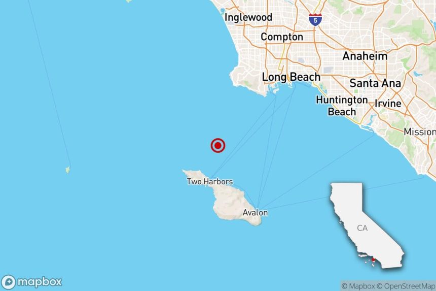
Emergency alerts lit up phones across Los Angeles County around 9:40 p.m. on February 22. The U.S. Geological Survey registered the event at magnitude 3.5, centered about 13 miles southwest of Rancho Palos Verdes in the Pacific Ocean.[3] Seismologists pinpointed the hypocenter at a depth of roughly 6.8 miles beneath the seafloor.[1]
This tremor occurred north of Catalina Island, placing it squarely in the seismically active Gulf of Santa Catalina. Initial readings held steady, with no upward revisions reported as of Monday morning. Authorities monitored for aftershocks, though none of significant size followed immediately.[2]
Felt Far and Wide
The quake registered on “Did You Feel It?” maps from the USGS, with reports streaming in from coastal communities. Residents in Palos Verdes Estates, Rolling Hills Estates, and Avalon on Catalina Island noted the shaking most acutely.[1]
Sensations extended inland to Long Beach, Inglewood, Torrance, Redondo Beach, Manhattan Beach, and Carson. Further east, people near Huntington Beach and even Fullerton in northern Orange County described brief rumbles.[2][4] Social media buzzed with accounts of swaying lights and rattling dishes, but the event lasted mere seconds.
- 13 miles from Rancho Palos Verdes
- 14 miles from Palos Verdes Estates
- 14 miles from Rolling Hills Estates
- 14 miles from Avalon, Catalina Island
- Felt up to northern Orange County
No Damage, Quick Recovery
Emergency services reported no injuries or structural issues. Fire departments in affected areas stood ready but logged no calls related to the quake. The moderate intensity aligned with expectations for a magnitude 3.5 event offshore, minimizing onshore effects.[2]
Local utilities confirmed no disruptions to power or water services. Traffic flowed normally on major routes like the Pacific Coast Highway, and Catalina ferry operations proceeded without interruption Monday.
Seismicity in a Fault-Lined Region
Southern California sits atop complex fault systems, including influences from the Newport-Inglewood fault zone extending offshore. The Gulf of Santa Catalina hosts active features like the Santa Cruz-Catalina Ridge, contributing to frequent minor events.[5][6]
Recent data showed one other magnitude 3.0 or greater quake nearby in the past 10 days. Over three years, the Greater Los Angeles area averages five quakes between magnitudes 3.0 and 4.0 annually, underscoring the routine nature of such activity.[1] Experts view these tremors as stress releases along plate boundaries.
Residents can report experiences at the USGS Did You Feel It? page.[1]
Key Takeaways
- Magnitude 3.5 quakes offshore rarely cause damage but serve as reminders to prepare.
- Felt reports help refine seismic models for future events.
- SoCal sees about five similar quakes yearly – vigilance remains essential.
This latest shake reinforces the unpredictable rhythm of life on the Pacific Ring of Fire. While Sunday’s event passed without incident, it prompts a check of emergency kits and family plans. What did you feel during the quake? Share in the comments below.


