
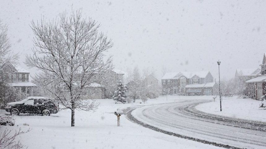

Colorado Snowstorm In May Could Be Its Biggest This Season – Image for illustrative purposes only (Image credits: Flickr)
Boulder, Colorado — Residents traded spring blooms for snow shovels as a powerful late-season storm barreled through the Rocky Mountains on May 5 and 6. Forecasters highlighted the event as potentially the heaviest snowfall of the 2025-2026 winter season, delivering critical moisture after months of record-low snowpack.[1] Boulder recorded more than 10 inches, while mountain peaks saw far greater totals.
Snowfall Piles Up in Dramatic Fashion
The storm unleashed heavy, wet snow across northern and central Colorado, with accumulations varying sharply by elevation. Areas near Rocky Mountain National Park bore the brunt, as reports confirmed nearly 28 inches in Estes Park and over 20 inches at Trail Ridge and Bear Lake.[2][3] Lower elevations experienced less but still notable amounts, including 11.3 inches in Boulder and 11 inches at Loveland Pass.
National Weather Service data captured the scope through early May 6. The list of preliminary totals painted a picture of widespread coverage, from foothills to high country passes.
- Estes Park: 27.9 inches
- Meeker Park: 26.1 inches
- Pinewood Springs: 23.7 inches
- Allenspark: 23.3 inches
- Boulder: 11.3 inches
- Denver International Airport: 5.5 inches
These figures marked the storm’s intensity, especially given the warm temperatures that preceded it.[4]
Daily Life Grinds to a Slushy Halt
Heavy snow complicated commutes and routines across the Front Range. Interstate 80 shut down temporarily between Laramie and Cheyenne in Wyoming, while slushy conditions plagued Interstate 25 north of Denver and stretches of Interstate 70.[4] Power outages affected tens of thousands, primarily in the Denver metro, as wet snow weighed down trees and lines.
Schools delayed openings or closed in the Denver area, and flights faced delays at the international airport. Tree damage emerged as a concern in Boulder and surrounding foothills, where leafy branches snapped under the load. A planned concert at Red Rocks Amphitheatre shifted dates amid the onslaught.[3]
What matters now: Travel remains hazardous on mountain passes, with winter storm warnings lingering into May 6 evening. Drivers faced whiteout risks from gusts up to 45 mph.
Relief After a Parched Winter
Colorado endured one of its driest winters on record, with snowpack levels dipping to historic lows since at least 1987. Cities like Cheyenne logged just 17.5 inches for the entire season prior to this event, far below average.[4] The May storm offered a timely reprieve, boosting water supplies and tempering wildfire threats.
While not erasing the deficit, the fresh layer nudged snowpack rankings away from the absolute bottom. Resorts like Arapahoe Basin extended operations briefly, capitalizing on north-facing slopes. Forecasters emphasized the storm’s role in a season otherwise defined by scarcity.[1]
Storm Tapers as Temperatures Plunge
Snowfall wound down from north to south across Colorado by late May 6, with lingering flurries possible into early Thursday. Temperatures dropped sharply, nearing records for the date.
The event underscored the Rockies’ unpredictable weather, where May snow remains feasible at elevation. Denver’s average May total hovers around 1-3 inches, making this outlier stand out.[5]
This late blast serves as a reminder of Colorado’s variable climate, providing essential hydration just as summer looms. The added snowpack could ease pressures on reservoirs and forests in the months ahead.


