
There are roads that simply outlive their original purpose. Boulder Highway in Southern Nevada is one of them. Built nearly a century ago to serve dam workers and desert travelers, the corridor has slowly transformed from a vibrant commercial artery into something more complicated: a stretch of faded motels, aging storefronts, struggling transit riders, and now, a billion-dollar bet on the future.
The question isn’t whether the corridor is changing. It already is, visibly and fast. The real tension is who that change is for, and whether the people who have long called this corridor home will still recognize it when the construction dust settles.
A Road Born from Hoover Dam
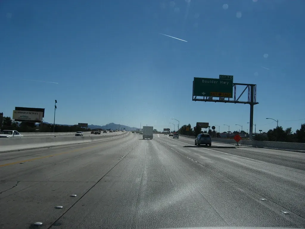
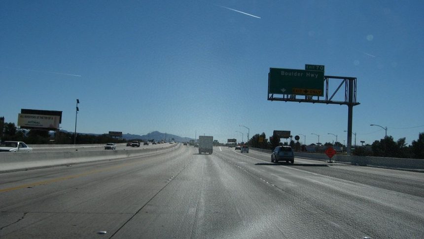
The 15.4-mile Boulder Highway was initially built in 1931 across what was then a mostly rural part of the valley to connect downtown Las Vegas with Railroad Pass in Henderson. Its original purpose was functional, not glamorous: moving workers, materials, and eventually residents through an undeveloped desert landscape.
At one time, Boulder Highway was the only road to connect the downtowns of Las Vegas, Henderson, and Boulder City, and throughout its history, it was a heavily traveled and vibrant corridor, lined with motels, casinos, and other businesses. For decades, it was Southern Nevada’s main commercial spine.
The extension of the U.S. 95 freeway in the 1980s led to a slowdown in business activity along the corridor. That slowdown never fully reversed, and the highway that once carried the region’s pulse slowly settled into a quieter, harder-edged version of its former self.
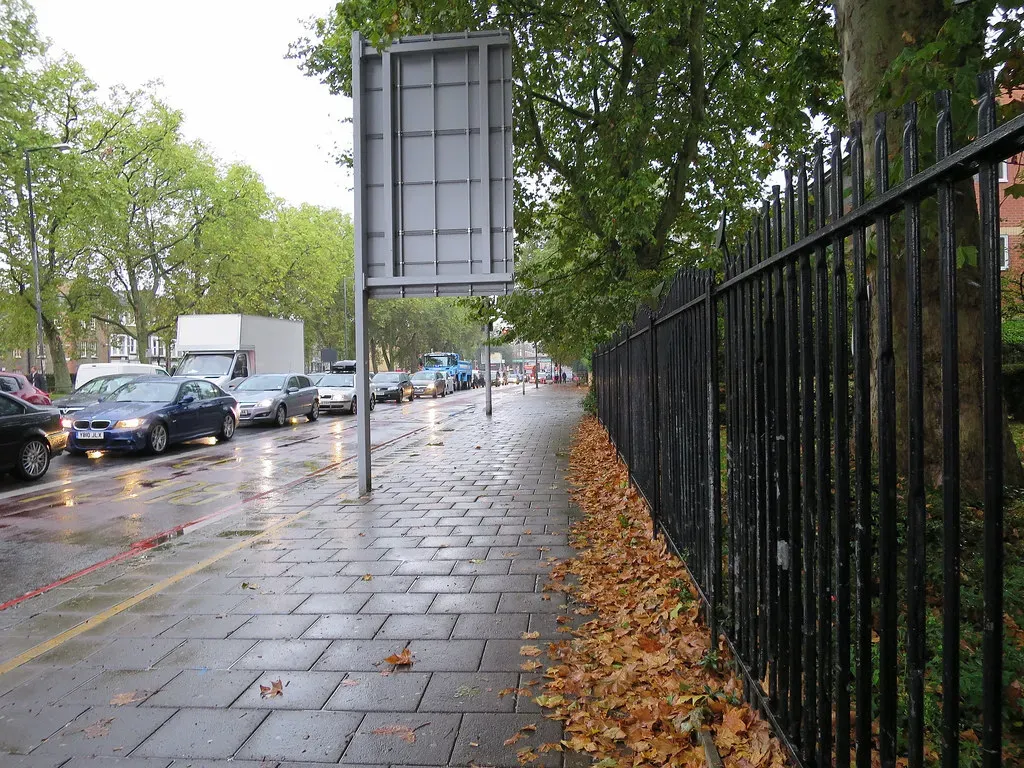
What the Corridor Looks Like Today
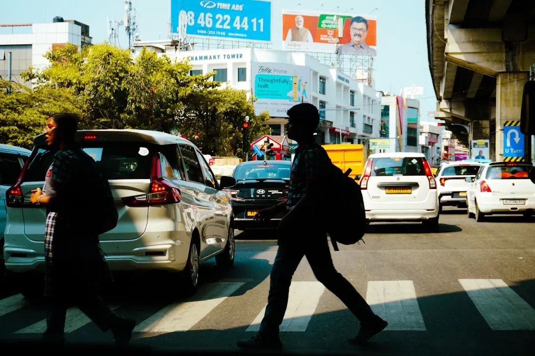
The southern stretch in Henderson is filled with faded buildings and shops, while further north are casinos that capture what Las Vegas might have looked like before the glitz and glam of the Strip captured everyone’s attention. It’s a corridor with genuine character, even if that character has been worn down by decades of deferred maintenance and disinvestment.
The area has expanded rapidly, with now 20,000 homes, apartments and condominiums and over 970 commercial lots within a half-mile radius of Boulder Highway, and the stretch of road sees 36,000 vehicles and 10,000 RTC transit riders daily. The numbers reveal a corridor that is still very much in use by a dense, mixed-income population.
Over the past six years, 25% of the fatalities in Henderson have been along Boulder Highway. That single statistic does more than anything else to explain why change became unavoidable. This isn’t just a road that looks worn out – it’s one that has been genuinely dangerous.
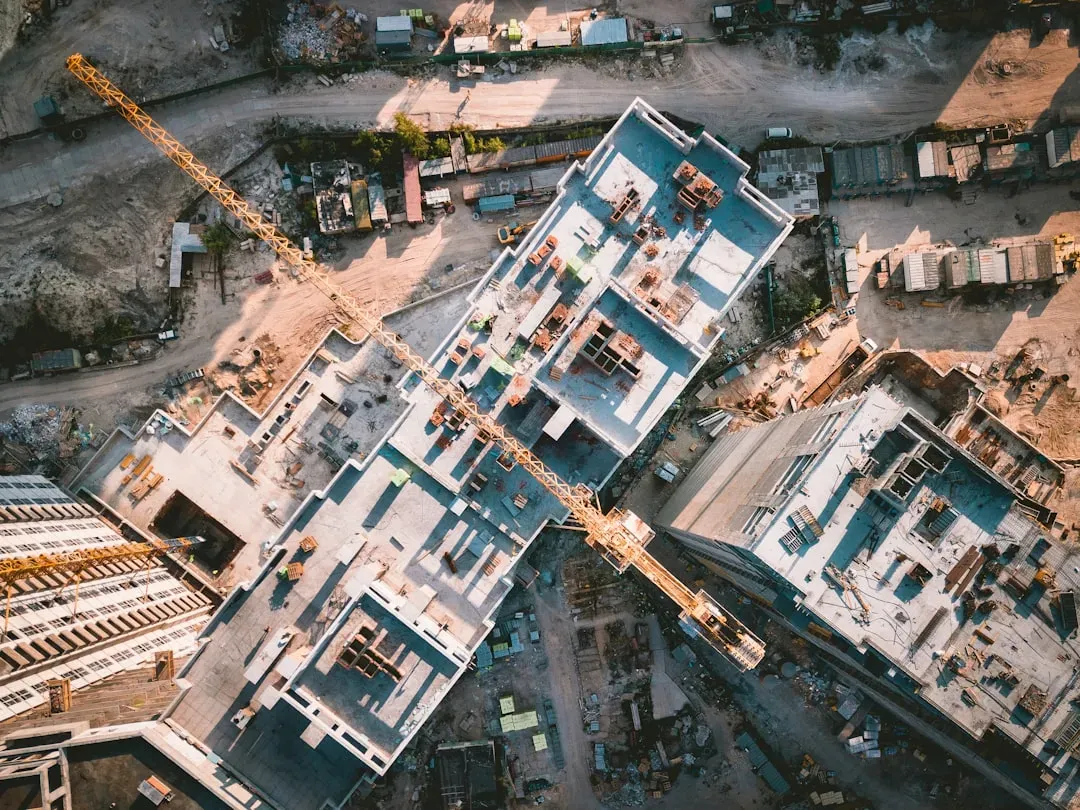
The $184 Million Reimagine Project
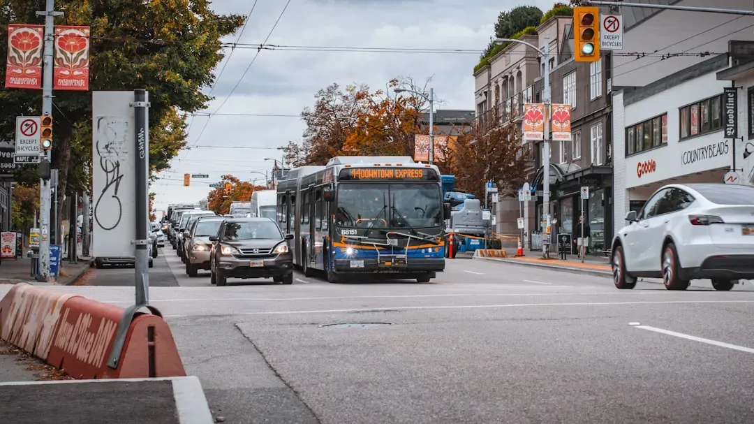
The $184 million project, which began in summer 2024, will reduce the number of traffic lanes from six to four, add wider sidewalks and elevated bike lanes on both sides of the road, and create a center-run bus rapid transit system along the 7.5 miles of Boulder Highway in Henderson. It’s an ambitious physical overhaul by any measure.
The project’s original $172 million budget grew by $12 million to $184 million late last year after the Regional Transportation Commission requested additional transit shelters. Budget increases during infrastructure projects are not unusual, but this one reflects how seriously the city and its partners are taking the corridor’s transformation.
The Reimagine Boulder Highway project recently hit the halfway point as construction continues along the 7.5-mile corridor. The Regional Transportation Commission’s $184 million project began construction in summer 2024, and crews are now focused on work along the remaining stretch after completing major utility and roadway preparation in 2025. Construction will continue through 2026 and is expected to be completed in 2027.
Federal Dollars Driving the Change

The City of Henderson was awarded $39.9 million in funding from the U.S. Department of Transportation’s Infrastructure for Rebuilding America (INFRA) grant program, with this funding helping to implement the City’s vision for Boulder Highway by enhancing automobile, bicycle, and pedestrian safety, lighting, and drainage throughout the corridor.
Most of the project budget came from federal funding, with $80 million coming from federal sources, $30 million from the city of Henderson, and the rest from flood control and other property owners nearby. The scale of federal investment signals that this corridor has moved from a local priority to a regional infrastructure commitment.
Some of that money has already been secured through grants like the Transit-Oriented Development (TOD) Planning program, which was funded under the Infrastructure Investment and Jobs Act of 2021. The infrastructure law has become a meaningful lever for corridors like this one across the country.
The Safety Case for Transformation
A regional study revealed a number of issues, including poor sidewalk design and lack of accessibility for able-bodied and disabled pedestrians, large and complex street crossings, limited bus stops, increased exposure to weather, and inconsistent lighting. These weren’t cosmetic problems. They were structural failures that had real consequences for real people.
Today, the area has grown to tens of thousands of houses, commercial lots, transit riders, and daily vehicles, and this growth has caused an increase in traffic for vehicles, bicycles, and pedestrians, but also an increase in pedestrian injuries and deaths. The road was simply never redesigned to match the density that grew around it.
Workers have installed over 20,000 feet of storm drains and five major connections near Lake Mead and Sunset to reduce flood risk, and upgraded wiring at all 17 intersections while installing 105 new streetlights, improving visibility and traffic flow. Behind the headline numbers, the ground-level upgrades are already measurable.
The Business Pain of Construction
The Reimagine Boulder Highway project still has a long way to go before it is officially completed, and the construction is impacting businesses, as the project will turn the corridor into a reimagined roadway with a center bus lane, more lighting, and more pedestrian-friendly features. The promise of the future does not pay today’s rent.
Reuben Ibarra, general manager of Sunset Tavern, said that a lot of people have been avoiding the area, and that foot traffic is down 30% since construction began in July 2024. That’s a significant blow to businesses already operating on thin margins in a corridor that wasn’t exactly booming before the orange cones arrived.
The more than 7-mile project will not be done until August 2027. For small business owners, that timeline is not just an inconvenience – it’s an existential pressure that could reshape which businesses survive long enough to see the corridor’s finished form.
Transit-Oriented Development and the Gentrification Risk
With center-running BRT coming to Boulder Highway, Henderson is engaging the community and stakeholders to create first and last mile connections, foster equitable access for all people, and develop design concepts, design guidelines, and zoning recommendations to foster Transit Oriented Communities around the eight BRT stations. The planning language is careful, but what happens in practice often diverges from what’s promised on paper.
Potential for new development such as housing, jobs, services, shops, and restaurants, along with the design layout, economic feasibility, and regulatory changes required to achieve them, will be created for station areas using a Transit Oriented Communities framework. Transit-adjacent development reliably raises nearby property values, and that has a well-documented downside for lower-income renters.
Gentrification is a process in which increased investment in a neighborhood drives up property values and rents, displacing lower-income residents by increasing prices so that such residents can no longer afford to live there. Whether Boulder Highway follows that pattern depends heavily on the policy choices made around its eight new BRT stations over the next several years.
Affordable Housing: Signals Within the Corridor
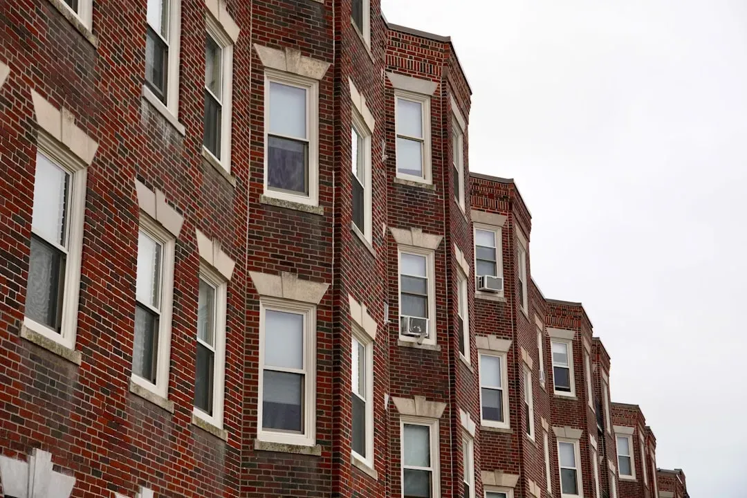
Sunrise Ranch Apartments, located at South Broadbent Boulevard and Boulder Highway in Henderson, will have 144 units, with 60 set aside for young adults leaving the foster care system to live independently, and was spearheaded by Nevada Housing and Neighborhood Development. It’s a concrete example that affordable housing development is happening alongside, not just after, the infrastructure investment.
The Sunrise Ranch Apartments will cost about $53.7 million to build, with the Nevada Housing Division providing about $32.6 million, Clark County contributing $13.1 million, and the city of Henderson giving about $3.2 million along with another $1.8 million in American Rescue Plan funding. Multiple funding layers were needed to make that kind of development viable.
Henderson’s Development Code includes provisions such as the affordable housing density bonus to support its housing goals, and was also amended in 2022 to include the same land use designation changes that are supportive of Transit Oriented Development at key locations. Policy tools exist, though their use is never guaranteed.
Brownfields, Vacant Lots, and the Property Ownership Question
The City of Henderson has been extending and expanding the implementation of the Boulder Highway Revitalize, Reuse, Renew program, which provides Phase 1 and Phase 2 environmental site assessments at no cost to local property owners, because the Boulder Highway Corridor has long been a key area for beautification, redevelopment, and enhanced economic opportunity.
The City of Henderson was awarded a Brownfield Community-Wide Assessment Grant through the U.S. Environmental Protection Agency (EPA), allowing the city to fund site research and perform environmental assessments on eligible properties in the area, since these assessments are frequently mandated by financial institutions for lending and investment purposes and test individual properties for potential ground contamination.
The goal is to position property owners to easily market their vacant or underutilized properties, or repurpose them for a higher return on investment. That framing makes obvious economic sense but also illustrates the tension clearly: higher returns on investment are not always synonymous with affordable outcomes for existing residents.
What the Corridor’s Future Actually Depends On
While the project is aimed at increasing safety and traffic flow to better suit the area as it is now, there is hope the layout will attract new businesses. Hope is a reasonable starting point, but urban history is littered with corridors where infrastructure investment arrived without the equity scaffolding needed to keep longtime residents in place.
At some point following the completion of the project, the roadway could go from being Boulder Highway to Boulder Parkway or another name to better reflect the new layout. A name change is symbolic, but symbolism matters. It signals who the corridor is being imagined for going forward.
High-capacity transit is desirable to live and work near, and the city’s study allows an evaluation of the economic forces that might impact station areas, with Henderson developing plans and policies for station areas to guide those forces appropriately. The outcome hinges on whether that guidance has actual teeth, or whether it functions more as aspiration than enforcement.
Conclusion: Growth With or Without Displacement
Boulder Highway’s transformation is real, funded, and already underway. The safety case for change was never seriously in dispute. Reimagine Boulder Highway will not only transform one of the City’s most historic roads, but will improve the surrounding area and create positive change for residents and businesses along the corridor for years to come, according to the city’s own framing.
Whether that promise holds for the people who are already there – the transit-dependent residents, the long-standing small businesses, the renters in older housing stock – is the question that infrastructure dollars alone cannot answer.
The corridor has survived the Hoover Dam rush, the freeway bypass of the 1980s, and decades of disinvestment. Its next chapter will likely be more prosperous by most economic measures. The harder work is ensuring that prosperity is distributed broadly enough to justify calling this growth, rather than simply gentrification with better lighting.


