

DAY 1 MARGINAL SEVERE WEATHER RISK FROM THE TEXAS HILL COUNTRY INTO THE UPPER TEXAS COAST…AND ACROSS THE CENTRAL GULF COAST INTO THE FLORIDA PANHANDLE…FORECAST SYNOPSIS…ISSUED MAY 01, 2026…11:55 A.M. EDT – Image for illustrative purposes only (Image credits: Unsplash)
From the Texas Hill Country through the upper Texas Coast and onward to the central Gulf Coast and Florida Panhandle, the Storm Prediction Center outlined a marginal risk for severe weather on May 1, 2026. Issued at 11:55 a.m. EDT, the Day 1 outlook highlighted potential for isolated severe wind gusts and hail amid ongoing thunderstorm activity. Conditions across these regions supported storms capable of sporadic impacts, prompting forecasters to urge vigilance through the evening.
SPC’s Day 1 Outlook Highlights Key Areas
The Storm Prediction Center delineated the marginal risk zone stretching from south-central and southeast Texas eastward along the Gulf Coast. Thunderstorms already underway in Texas that morning carried forward into the afternoon, with activity expected to shift toward the Gulf states later in the day. Forecasters noted that preceding showers might temper some development, yet persistent instability promised pockets of stronger storms.
Slight risk appeared in Day 2 graphics, while marginal chances lingered into Sunday. Black hatched areas on newer outlooks signified conditional intensity groups, denoting elevated potential in favored spots. Updates from the center, including the next issuance at 12:30 p.m. EDT, refined these boundaries based on evolving data.
Primary Threats: Hail and Damaging Winds
Isolated hail and damaging wind gusts emerged as the chief concerns within the outlined areas. Probabilities included a 5% chance for one-inch hail or larger, with hatched zones indicating 10% odds for two-inch stones in select locations. Damaging winds reached potential gusts over 50 knots, escalating to 65 knots or higher in stronger cells.
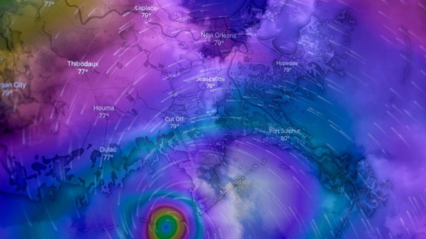
Tornado odds remained low at 2% overall, confined to weak EF0-EF1 spin-ups if any materialized. Along the central Gulf Coast, evening storms posed the greatest hazard as a surface low tracked northeastward off the Texas and Louisiana coasts. This setup introduced minor tornado potential in near-coastal warm sectors of southeast Louisiana, southern Mississippi, Alabama, and the western Florida Panhandle.
Atmospheric Setup Fuels Storm Potential
A shortwave trough progressed eastward through Texas toward the Lower Mississippi Valley, bolstering mid-level flow and large-scale ascent. Modest elevated instability held steady, with southwesterly winds aiding storm organization despite flat thermodynamics. Deep-layer shear strengthened slightly, fostering more robust structures amid scattered convection.
Surface development featured a low pressure system over the western Gulf, advancing rapidly toward southern Plaquemines Parish by early Saturday. Warm-air advection ahead of the trough sparked elevated thunderstorms across the Lower Mississippi Valley, where small hail threatened the most intense updrafts. Model guidance from NAM 3km, HRRR 3km, and others aligned on these patterns, though peak values occasionally skewed south of primary outlines.
Key Forecast Indices Signal Limited but Real Hazards
Analyses revealed a marginally to moderately unstable environment, with SBCAPE ranging 250-2000 J/kg, MLCAPE 250-1250 J/kg, and MUCAPE up to 2000 J/kg. Storm-relative helicity values hit SRH 0-1 km at 100-225 m²/s² and 0-3 km at 200-400 m²/s², supporting supercell potential. Effective shear climbed to 40-60 knots, complemented by lifted indices of -1 to -6 and mid-level lapse rates around 6.0-6.5°C.
Composite parameters underscored the setup: Supercell Composite Parameter (SCP) at 1-8, Significant Tornado Parameter (STP) 0.4-1.6, and supercell Energy Helicity Index (EHI) 0.3-3.1. Dewpoints spanned 59-73°F, fueling total totals index near 47°C and K-index 26-34°C. These metrics, drawn from proximity soundings, pointed to isolated severe outcomes rather than widespread events. For deeper context, resources like the NWS environmental indices page detail parameter thresholds.
- CAPE: Measures atmospheric instability for thunderstorm growth.
- SRH: Gauges rotation potential in supercells; values over 100 m²/s² (0-1 km) heighten tornado threats.
- STP: Values above 1 often link to significant tornadoes in analyzed soundings.
- SCP: Blends helicity, CAPE, and shear for supercell favorability.
Staying Prepared Amid Evolving Conditions
Strong to severe storms already traversed Texas risk areas that morning, eyeing Gulf Coast initiation by late afternoon through evening. Forecasters emphasized monitoring via the SPC homepage for mesoscale discussions, convective watches, and outlook tweaks. Local National Weather Service offices provided radar loops and watch/warning maps for real-time updates.
Residents in affected zones prepared for hail capable of vehicle damage and winds snapping tree limbs. While risks stayed marginal, isolated impacts warranted caution, especially near coasts. As the shortwave trough departed, threats diminished overnight, shifting focus to subsequent days’ outlooks.
This forecast underscored the value of layered data – from probabilities like NADOCAST to model simulations – in pinpointing hazards. Communities along the path stayed alert, ready to act on any escalation.


