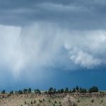


6:00 AM | ****A major snow event continues…heavy, wet snow and difficult travel conditions**** – Image for illustrative purposes only (Image credits: Unsplash)
Denver – A powerful snow event gripped the metro area through early Wednesday, dumping 6-10 inches of heavy, wet snow and complicating commutes. Temperatures lingered in the upper 30s amid breezy north-northeast winds of 10-20 mph, keeping roads slick near the freezing mark. The storm followed a surge of colder air on Tuesday, marking a stark seasonal shift before warmer weather returns later in the week.
Heavy Snow Persists Amid Chilly Conditions
Mainly cloudy skies dominated as periods of intense snow continued into the morning hours. Accumulations reached 6-10 inches across the Denver metro region, with even greater totals reported near the foothills. The snow’s heavy, wet nature added to the challenges, weighing down branches and slowing plows.
Breezy conditions exacerbated the situation, with north-northeast gusts up to 20 mph whipping surface snow into drifts. Highs struggled to climb out of the upper 30s, maintaining a wintry feel despite the late-season timing. Meteorologist Paul Dorian of Arcfield Weather highlighted the event’s significance in his forecast discussion.
Travel Disruptions Dominate the Day
Morning travel proved particularly treacherous, as temperatures hovered around freezing in many spots. Drivers faced reduced visibility and hazardous roads, prompting warnings from local authorities. The combination of fresh snowfall and marginal warmth turned interstates and arterials into slippery obstacles.
Officials urged caution, recommending extra travel time and winter tires where possible. School delays and remote work options emerged in response to the conditions. The wet snow clung to vehicles and infrastructure, prolonging cleanup efforts into the afternoon.
Snow Showers Linger Into Evening
Tonight brought mainly cloudy and breezy skies, with cold air settling in for lows in the upper 20s. Snow showers remained possible during the evening hours, potentially adding a light dusting to already burdened areas. Winds continued to ease slightly, but the chill sharpened overnight.
Residents prepared for the drop by securing outdoor items and checking heating systems. The evening outlook signaled a brief pause before the pattern shifted dramatically.
Warming Trend Ushers in Milder Days
Thursday dawned mainly sunny and much milder, with afternoon highs reaching the low-to-mid 60s. This marked a rapid departure from the snow, as high pressure built in. Partly cloudy conditions returned Thursday night, accompanied by a chance of showers and thunderstorms and lows near 40 degrees.
Friday through Monday featured partly sunny skies, breezy at times, and building warmth. Highs climbed into the lower 70s on Friday and Saturday, then eased to the mid-to-upper 60s on Sunday before surging to the upper 70s on Monday. Scattered chances for showers and thunderstorms persisted over the weekend, reflecting an active pattern.
Key Forecast Highlights:
- Today: Snow, 6-10 inches, upper 30s.
- Tonight: Snow showers possible, upper 20s.
- Thursday-Saturday: 60s to 70s, shower chances.
- Sunday-Monday: 60s to upper 70s, partly sunny.
The swift transition from snow-covered streets to spring-like warmth underscores Colorado’s variable climate. As plows cleared the latest round, attention turned to the weekend’s potential storms. Forecasters advised monitoring updates, given the region’s penchant for sudden changes.