


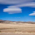
Overcast but Pleasant Conditions Greet the Day (Image Credits: Unsplash)
Las Vegas – A layer of clouds will dominate the skies over Las Vegas today, April 6, keeping conditions warm despite the overcast look. Temperatures are set to reach the low to mid-80s, offering a comfortable spring day for outdoor activities. Forecasters anticipate a volatile week, with heat building midweek before a sharp drop and possible thunderstorms arrive over the weekend.[1][2]
Overcast but Pleasant Conditions Greet the Day
Cloudy skies will persist through much of today in Southern Nevada, transitioning from partly cloudy mornings to more persistent cover by afternoon. Highs are expected to climb into the 84°F range, with lows dipping to around 58°F overnight. Light winds from the southeast at 5 to 10 mph will accompany the warmth, making for mild evening strolls along the Strip.[1]
This setup provides a gentle introduction to the week’s shifts. Residents have grown accustomed to such desert variability, where morning clouds often yield to sun later. No precipitation chances appear today, allowing events and tourism to proceed uninterrupted.
Midweek Surge Brings Triple-Digit Tease
Temperatures will climb steadily starting Tuesday, peaking Wednesday with highs near 89°F under mostly sunny skies. Clear nights will keep lows in the low 60s, fostering comfortable sleeping conditions. The warming trend stems from an upper-level ridge over the Southwest, trapping heat in the region.[2]
Thursday maintains the pattern with partly cloudy conditions and highs around 85°F. Friday sees a slight dip to 80°F, still above average for early April. These days favor poolside lounging and hiking in nearby Red Rock Canyon, though hydration remains essential amid low humidity.
Weekend Cool-Down Packs Thunderstorm Punch
The rollercoaster peaks with a dramatic change by Saturday, as scattered thunderstorms bring highs down to 71°F and lows to 52°F. Precipitation chances rise to 43%, potentially delivering brief but intense downpours. Sunday stays cooler at 70°F highs with lingering clouds and a 15% shower risk.[1]
This influx of cooler, moist air disrupts the heat dome. Gusty winds could accompany storms, impacting outdoor plans like golf or festivals. The shift underscores spring’s unpredictability in the Mojave Desert.
Weekly Forecast at a Glance
| Date | High/Low (°F) | Conditions | Precip % |
|---|---|---|---|
| Mon, Apr 6 | 84 / 58 | Cloudy | 0 |
| Tue, Apr 7 | 88 / 62 | Sunny | 0 |
| Wed, Apr 8 | 89 / 63 | Sunny | 0 |
| Thu, Apr 9 | 85 / 62 | Partly Cloudy | 0 |
| Fri, Apr 10 | 80 / 59 | Partly Cloudy | 2 |
| Sat, Apr 11 | 71 / 52 | Scattered T-Storms | 43 |
| Sun, Apr 12 | 70 / 52 | Partly Cloudy | 15 |
Data compiled from leading forecasts shows the clear progression from warmth to volatility.[1]
Preparation Tips for Shifting Skies
Locals and tourists alike should adjust plans for the fluctuations. Layer clothing for mornings and evenings, especially as weekend chills arrive.
- Pack sunscreen and hats for midweek sun exposure.
- Secure outdoor items ahead of potential weekend gusts.
- Monitor updates from the National Weather Service for thunderstorm warnings.
- Stay hydrated regardless of conditions – desert air dries quickly.
- Opt for indoor alternatives like shows if storms brew Saturday.
Key Takeaways
- Enjoy warm, cloudy comfort today before heat peaks midweek.
- Watch for Saturday’s 43% thunderstorm chance and 20-degree temp drop.
- No major alerts now, but check local sources daily.
Las Vegas weather delivers its signature surprises this week, blending balmy days with stormy intrigue. The contrast keeps the city vibrant. How will you adapt your plans? Tell us in the comments.


