
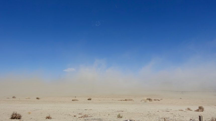
Key Details from the National Weather Service (Image Credits: Unsplash)
Las Vegas Valley – The National Weather Service issued a wind advisory early Tuesday morning for southern Nevada that activated at 2 p.m.[1][2] Officials expect southwest winds of 20 to 30 mph with gusts reaching 45 mph through 11 p.m., affecting driving conditions and outdoor activities across the region. This alert covers key areas including Clark County and extends into parts of neighboring states. Residents have taken note as the valley often experiences such spring gusts.
Key Details from the National Weather Service
The advisory, released at 12:34 a.m. PDT by the National Weather Service Las Vegas office, targets specific wind thresholds that pose risks to daily life.[1] Southwest winds will sustain at 20 to 30 mph, with peaks up to 45 mph in gusts. These conditions mirror patterns seen in April when pressure systems shift across the Southwest.
Forecast models indicate the strongest activity during the late afternoon and evening hours. The alert aligns with zone forecasts for NVZ020, the Las Vegas Valley area.[3] Temperatures remain mild, with highs in the upper 80s earlier in the day dropping to lows around 60 overnight.
Areas Under the Advisory
Southern Nevada bears the brunt, including Las Vegas, Henderson, North Las Vegas, Boulder City, and Pahrump. The warning spans all of Clark County and most of Lincoln County.[2] It also reaches portions of northwestern Arizona and southeastern California, naming places like Bullhead City, Kingman, Laughlin, and Barstow.
Other spots listed include Moapa, Searchlight, Mesquite, and Primm, along with landmarks such as Red Rock Canyon, Hoover Dam, and Mt. Charleston. High wind warnings apply elsewhere, like central Nye and Esmeralda counties, where gusts could hit 60 mph.[1][2]
Expected Impacts on the Region
Gusty conditions threaten unsecured objects, which could scatter across streets and yards. Tree limbs face the risk of snapping, potentially leading to minor disruptions.[1] Power outages remain a possibility in isolated spots where winds topple lines or debris interferes.
Driving challenges intensify, particularly for high-profile vehicles like trucks and RVs susceptible to crosswinds. Patchy blowing dust may reduce visibility during peak hours Tuesday night.[3] Aviation at Harry Reid International Airport could see delays, though no specific disruptions were noted yet. Outdoor events and construction sites require extra vigilance.
Safety Measures for Residents
Officials urge securing loose items such as patio furniture, trash cans, and holiday decorations before winds ramp up. Parking cars in garages offers protection from potential flying debris.
Drivers should reduce speeds, increase following distances, and avoid highways if possible during gusts. High-profile vehicles demand special caution on interstates like I-15 and I-215.[1]
- Secure or bring indoors lightweight objects prone to blowing away.
- Trim dead tree branches that could fall.
- Charge devices and have flashlights ready for any outages.
- Monitor local updates via the NWS Las Vegas Valley zone forecast.
- Avoid elevated areas like mountain passes where winds intensify.
- Report downed power lines to NV Energy immediately.
Key Takeaways
- Southwest winds 20-30 mph with 45 mph gusts from 2 p.m. to 11 p.m.
- Secure objects and drive carefully to minimize risks.
- Check NWS for updates as conditions evolve.
As the sun sets over the neon skyline, Las Vegas residents prepare for a blustery evening that underscores the desert’s unpredictable spring weather. Staying proactive ensures safety amid these routine yet potent gusts. What precautions are you taking tonight? Tell us in the comments.


