
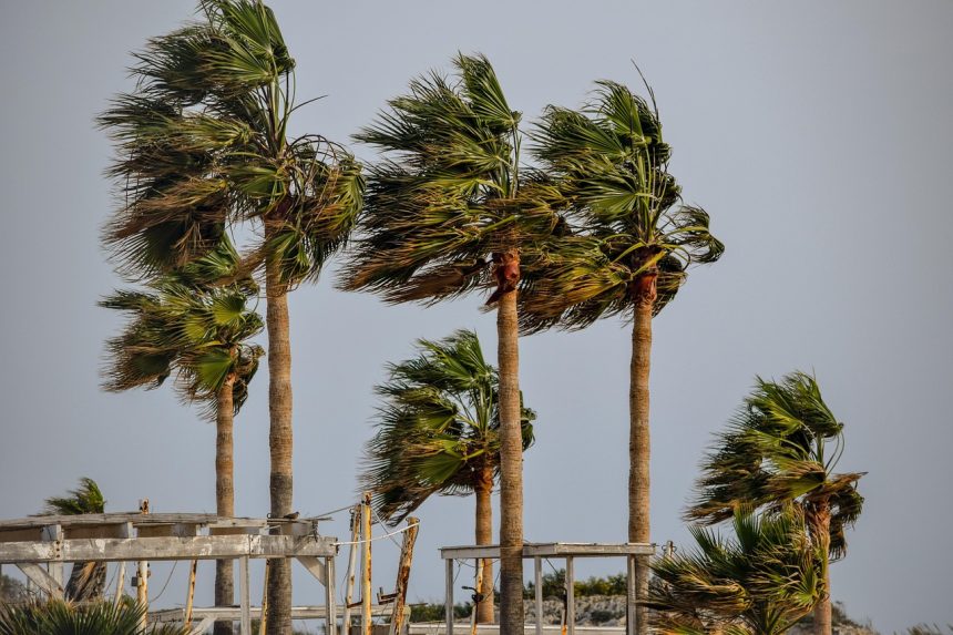

Gusty Conditions Dominate the Night (Image Credits: Pixabay)
Las Vegas – Residents and visitors in the Las Vegas Valley prepared for a gusty night as a low-pressure system barreled through the region. Winds reached speeds of 25 to 35 mph with gusts up to 50 mph under mostly clear skies.[1][2] Temperatures dipped into the 50s overnight, marking a shift from recent warmth. The National Weather Service issued a Wind Advisory that remained active until early Wednesday morning.[1]
Gusty Conditions Dominate the Night
Southwest winds fueled the turbulent evening, pushing gusts between 35 and 40 mph across much of the valley.[2] Patchy blowing dust reduced visibility in spots, complicating drives along major routes. Lows settled at 49 to 58 degrees, cooler on the west side of the valley and slightly milder eastward.[1]
Forecasters attributed the blustery weather to a passing area of low pressure. Conditions stayed mostly clear despite the wind, offering starry views for those undeterred by the gales. The advisory warned of potential hazards from unsecured objects and tree limbs.
Wind Advisory Highlights Key Risks
The National Weather Service extended the Wind Advisory through 5 a.m. Wednesday, citing gusts that could top 50 mph in stronger bursts.[1][3] Strong winds posed dangers to roofs, trees, and outdoor structures throughout the evening. Drivers faced challenges from crosswinds and dust, particularly on interstates and rural roads.
Local meteorologists at KTNV noted southwest winds at 20-25 mph with peaks near 40 mph.[2] No widespread power outages occurred, though vigilance remained key. The system moved swiftly, setting the stage for calmer air by dawn.
Breezy but Brighter Wednesday Awaits
Wednesday brought sunny skies and lighter breezes, with highs reaching 72 to 79 degrees across the valley.[1] West to northwest winds eased to 10-20 mph, gusting occasionally to 25 mph. Temperatures ran below seasonal norms, providing a refreshing break from prior heat.
Visitors to the Strip and outdoor venues enjoyed the mild conditions after the overnight drama. Highs hit the mid-70s in central areas, ideal for midday activities. The cooldown followed the low-pressure exit, stabilizing the atmosphere.
Extended Outlook Signals Mixed Weekend
Thursday promised mostly sunny weather with highs near 80 degrees and minimal winds from the southwest at 5-10 mph.[2] Friday warmed into the low 80s under similar calm patterns. The weekend introduced returning breezes, keeping highs in the upper 70s.
Forecasters monitored for any lingering effects from the system. No precipitation appeared on the horizon, maintaining dry desert norms. The shift underscored spring’s variable weather in Southern Nevada.
| Day | Conditions | High/Low (°F) | Winds |
|---|---|---|---|
| Tonight | Clear, windy, patchy dust | 49-58 | SW 25-35 G50 |
| Wednesday | Sunny, breezy | 72-79 / ~50 | W 10-20 G25 |
| Thursday | Mostly sunny | 80 | SW 5-10 |
- Secure loose outdoor items before gusts peak.
- Check visibility if driving at night due to blowing dust.
- Expect cooler mornings; layer clothing for early outings.
- Monitor updates from National Weather Service.
- Ideal conditions emerge midweek for outdoor plans.
Key Takeaways:
- Wind Advisory ended early Wednesday with gusts up to 50 mph overnight.[1]
- Wednesday highs in the 70s offer breezy comfort below normal.
- Weekend brings lighter winds and upper 70s temperatures.
The windy interlude reminded Las Vegans of the desert’s unpredictable springs, but calmer days lie ahead. Plan outdoor events with the breezy forecast in mind. What are your plans under these skies? Tell us in the comments.


