


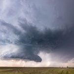
HEAVY SNOW IMPACTS THE FRONT RANGE – Image for illustrative purposes only (Image credits: Pexels)
Front Range — A powerful late-season snowstorm continued to affect the Front Range of the Rockies on Tuesday, stretching from Wyoming across Colorado and reaching into the nearby High Plains. Forecasters pinpointed the heaviest accumulations along the Interstate 25 corridor. As much as 8 inches or more of snow fell in those areas from late evening into Wednesday morning.
Core Path of the Storm
The storm centered its force on the Interstate 25 corridor, a vital artery connecting major cities in the region. This stretch saw the most intense snowfall rates, leading to rapid buildup overnight. Conditions worsened as the system moved steadily through the area.
Snow extended beyond the immediate corridor. It pushed eastward into portions of the High Plains, catching some lower elevations off guard during this time of year. The combination of cold air and moisture fueled the event’s potency.
Expected Snowfall Amounts
Officials projected at least 8 inches along the I-25 path, with some spots potentially seeing even higher totals by Wednesday. Lighter amounts blanketed surrounding zones, still enough to complicate routines. The late timing amplified challenges for communities transitioning toward warmer months.
Accumulations varied by elevation and exposure. Higher terrain in the Rockies caught the initial bands, while plains areas dealt with steadier falls later. Monitoring stations reported consistent rates through the night.
- Interstate 25 corridor: 8+ inches
- Wyoming to Colorado Front Range: Widespread snow
- Adjacent High Plains: Spreading coverage
Regional Reach and Timing
The system originated farther north before diving into Wyoming. It tracked southward through Colorado, maintaining strength over the Front Range. By midweek, lighter flurries lingered in the High Plains.
Tuesday night marked the peak, with snow tapering by Wednesday afternoon in most locations. Travel hubs along I-25 bore the brunt early. Crews mobilized to clear key routes as visibility dropped.
Why This Storm Stands Out
Late-season events like this one disrupt typical spring patterns in the Rockies. The Front Range, known for its urban-rural mix, felt the full weight of the surprise dump. Highways and local roads turned slick under the fresh powder.
Residents prepared for isolated power issues and delayed commutes. The storm served as a reminder of the region’s unpredictable weather shifts. Conditions improved steadily into Thursday, allowing recovery efforts to proceed.


