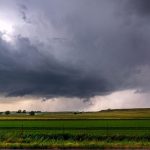


The sheer scale of this supercell storm over a country road – Image for illustrative purposes only (Image credits: Pixabay)
A supercell thunderstorm can stretch across the horizon in ways that make even familiar country roads feel newly vast. Its rotating structure and towering clouds create a visual contrast against flat fields and narrow lanes that few other weather events match. Observers often note how the storm’s scale shifts perspective, turning an everyday drive into something far more imposing.
How These Storms Organize in Open Terrain
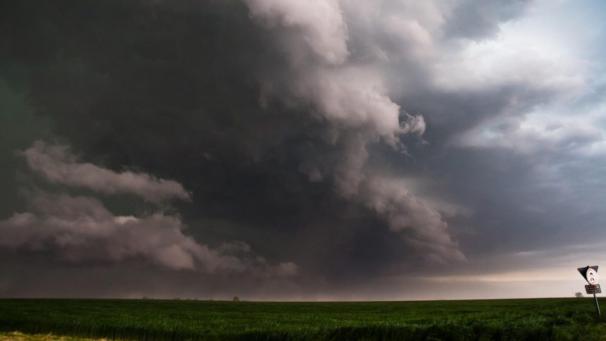
Supercells develop when warm, moist air rises rapidly and begins to rotate, forming a persistent updraft that can last for hours. In rural settings the lack of tall buildings or dense tree cover allows the full height and width of the cloud to stand out clearly. This visibility helps explain why images from country roads frequently circulate widely online. The flat landscape also lets the storm’s outflow boundaries and flanking lines remain visible for longer distances. Drivers and residents along these routes sometimes report the sudden drop in temperature and shift in wind direction well before the main core arrives. Such cues underscore the organized nature of the system rather than random cloud buildup.
Why Rural Roads Offer a Unique View
Country roads provide an unobstructed line of sight that urban areas rarely allow. Without nearby structures to block the view, the storm’s anvil can appear to stretch from one horizon to the other. This perspective highlights the sheer vertical development that defines supercells. Photographs taken from these locations often capture both the storm’s base and its upper-level features in a single frame. The result is a sense of proportion that is difficult to convey in words alone. Many who witness the event describe feeling momentarily small against the sky.
What Matters Now
- Supercells remain among the most long-lived thunderstorm types.
- Rural vantage points reveal their full structure more readily than city views.
- Continued monitoring helps communities prepare for associated hazards.
The image of such a storm above a quiet road serves as a reminder that severe weather can appear suddenly even in seemingly peaceful surroundings. As forecasting tools improve, the ability to anticipate these formations continues to advance. Yet the visual impact captured from rural vantage points keeps drawing fresh attention each season.