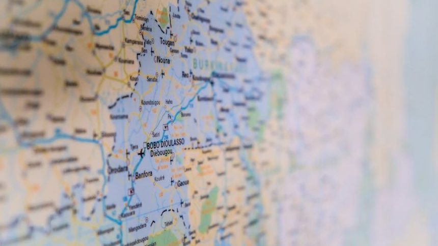
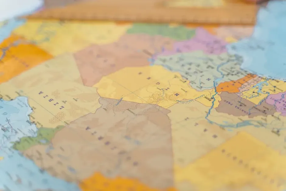
The world map you see today is not a natural fact. It is a negotiated, contested, sometimes violently imposed product of centuries of war, diplomacy, and colonial ambition. Every border line you trace with your finger was drawn by someone, somewhere, often for reasons that had nothing to do with the people who lived on either side of it.
Some of these borders vanished quietly. Others collapsed in fire and revolution. A few simply became irrelevant, absorbed into the flow of history. Here are seven of the most fascinating, world-shaping, and largely forgotten dividing lines that once carved up our planet. Some will surprise you. Let’s dive in.
The Iron Curtain: A Wound Across an Entire Continent

The Iron Curtain was the political and physical boundary that divided Europe from the end of World War II in 1945 until the end of the Cold War in 1990 and 1991. Honestly, calling it a “border” almost undersells what it was. It wasn’t just barbed wire and concrete. It was a rupture in the fabric of everyday life.
The Iron Curtain wasn’t just a line on a map. Stretching from the Baltic Sea in the north to the Adriatic in the south, it sliced through countries, families, and lives with chilling efficiency. Over time, economic and military alliances developed into broader, more entrenched cultural barriers, with widespread distrust on both sides deepening. Initially, the term described physical barriers such as razor wire, fences, fortified walls, minefields, and watchtowers along the western border of the Eastern Bloc.
Before 1950, over fifteen million people emigrated from Soviet-occupied eastern European countries to the west in the five years immediately following World War II. However, restrictions implemented during the Cold War stopped most east-west migration, with only about thirteen million migrations westward between 1950 and 1990. That figure alone shows just how completely this border froze people in place. The end of the Iron Curtain led to massive migrations, economic shocks, and the birth of new democracies that still shape Europe today.
The Inner German Border: When One Country Became Two

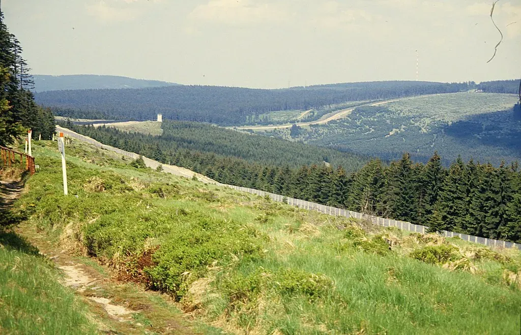
The border dividing East and West Germany was formed at the end of World War II, when Germany was occupied and administered by the four Allied Powers. The territories controlled by the United States, the United Kingdom, and France were combined to form West Germany. The area controlled by the Soviet Union became East Germany. Think about that for a moment. A nation, split in half by the political rivalries of powers that weren’t even German.
While the Berlin Wall cut through one city, the Inner German Border ran the length of the country, stretching 1,393 kilometers from the Baltic Sea to Czechoslovakia. It was a high-security zone, lined with barbed wire, watchtowers, and landmines, separating East and West Germany with ruthless efficiency. Entire villages vanished as residents were relocated to prevent escapes. During the years of the Wall, around 5,000 people successfully defected to West Berlin. That number represents real lives, real desperation, and real courage.
In 1990, following the fall of communism in Eastern Europe, Germany was reunified and the border was dissolved. You can still see the path of the Berlin Wall from space, because of the different color of the lightbulbs in east and west Berlin. That tiny detail always gets me. A border so total that even its ghost lingered in the streetlights.
The Sykes-Picot Line: The Secret Deal That Set a Region on Fire

The Sykes-Picot Line was drawn in secret by British and French diplomats in 1916, carving up the Ottoman Empire’s Middle Eastern lands with little regard for the people living there. This arbitrary border sliced through ethnic and religious communities, planting the seeds for a century of conflict. Here’s the thing about this one: it is arguably the single most consequential line ever drawn on a map in terms of the chaos it unleashed.
The drawing of borders post-World War I created discord among nations and ethnic groups throughout the Middle East. The Sykes-Picot Agreement largely ignored historical and cultural realities, establishing boundaries that sowed seeds for conflict lasting decades. The people who drew this line were sitting in London and Paris, thousands of miles away from the communities they were dividing. It shows.
Iraq, Syria, Lebanon, and Palestine are places whose headlines still echo with the repercussions of this deal. Many historians and analysts point to the Sykes-Picot Line as a root cause of the region’s endless struggles, as the line ignored historical realities on the ground. Over half of the world’s borders today were drawn as a result of British and French imperialism. That statistic is shocking when you sit with it. A legacy written in conflict that is still playing out in 2026.
The Austro-Hungarian Border: A Patchwork Empire Erased Overnight
Austria-Hungary was a multi-national constitutional dual empire in Central Europe between 1867 and 1918. A military and diplomatic alliance, it consisted of two sovereign states with a single monarch who was titled both the Emperor of Austria and the Apostolic King of Hungary. Governing something that complex was always going to be precarious, like trying to hold water in your hands.
As a multi-national empire and great power in an era of national awakening, it found its political life dominated by disputes among its eleven principal national groups. The more immediate reasons for the collapse of the state were World War I, the worsening food crisis since late 1917, general starvation during the winter of 1917 to 1918, and the demands of its military alliance with the German Empire, resulting in uncontrollable civil unrest and nationalist secessionism.
The dissolution of the Austro-Hungarian Empire post-1919 had a profound impact on the wider geopolitical landscape of Central Europe. The empire, known for its complex amalgamation of diverse ethnic and cultural groups, ceased to exist, giving rise to the establishment of new independent nations. The creation of Czechoslovakia, Yugoslavia, and Austria marked a significant shift toward national self-determination, reflecting the aspirations of various ethnic communities. The demarcation of boundaries often resulted in the fragmentation of ethnic groups, leaving minorities scattered across different newly formed states. This situation fueled tensions and laid the groundwork for future ethnic conflicts, contributing to the volatility of the region.
The 17th Parallel: Vietnam’s Cold War Wound

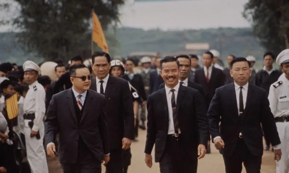
At the Geneva Conference in July 1954, peace accords were signed, but they ultimately resulted in Vietnam being divided at the 17th parallel north between the Communist Bloc-allied North Vietnam and the Western Bloc-allied South Vietnam. This division was never supposed to be permanent. It was designed as a temporary ceasefire line, a holding measure until elections could unify the country. Those elections never happened.
The Vietnam War erupted between North Vietnam, supported by the Soviet Union and China, and South Vietnam, backed by the United States. Millions of lives were lost defending or attacking that line on the map. What began as a political compromise became the defining tragedy of an entire generation, in Vietnam and far beyond its borders.
The Paris Peace Accords were signed in 1973, resulting in the withdrawal of U.S. troops, but fighting continued between North and South Vietnam. On April 30, 1975, Saigon fell to North Vietnamese forces, marking the official collapse of South Vietnam. The 17th parallel border, which had cost so much blood to defend, dissolved in a matter of weeks. Today, a unified Vietnam stands where two cold-war client states once faced each other across a line in the jungle. It’s hard to say for sure whether history remembered this border fairly.
Neutral Moresnet: The Tiny Zinc-Powered Nation Nobody Remembers

This one is genuinely wild. Most people have never heard of it, which is a shame, because the story of Neutral Moresnet is one of the strangest border experiments in all of European history. Neutral Moresnet was a small Belgian-Prussian condominium in western Europe that existed from 1816 to 1920 and was administered jointly by the United Kingdom of the Netherlands, Belgium after its independence in 1830, and the Kingdom of Prussia. It was just 1.5 kilometers wide and 2.5 kilometers long, with an area of 3.5 square kilometers.
The peculiar arrangement came about because of the presence of a valuable zinc spar mine. In the 19th century, deposits of this kind were rare, with one of the few other places in Europe where zinc was being processed being Bristol. Neither the Netherlands nor Prussia was willing to concede the mine, so they both agreed to administer the district jointly as a neutral condominium in 1816. The solution was essentially a shrug. Nobody wins, nobody loses, and they called it a country.
At its height, perhaps 4,000 people lived there. They enjoyed full employment, low taxes, and an exemption from compulsory military service to either of its custodians. In 1908, a doctor named Wilhelm Molly proposed to turn Neutral Moresnet into the world’s first Esperanto-speaking state, named Amikejo, or “friendship-place.” Germany annexed it during World War I, but the Treaty of Versailles awarded the territory to Belgium. Neutral Moresnet was renamed Kelmis and converted into a Belgian municipality in 1920. A bizarre, beautiful little country, gone before most of the world even knew it existed.
The Borders of Gran Colombia: A Dream That Lasted Just Over a Decade
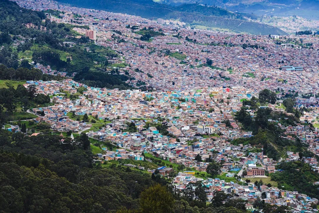
Gran Colombia was a grand experiment, a single nation uniting modern-day Colombia, Venezuela, Ecuador, and Panama. Simón Bolívar, the great liberator of South America, envisioned it as a powerful unified republic capable of standing up to European imperial powers. The dream was breathtaking in scope. The reality, unfortunately, was far messier.
The internal borders of Gran Colombia were constantly contested. Regional identities proved stronger than revolutionary idealism. Venezuela and Ecuador both chafed under centralized rule from Bogotá, and political rivalries between Bolívar and his contemporaries fractured the republic from within. It is one of history’s great what-ifs. Had it survived, the geopolitical shape of South America would look entirely different today.
Arbitrarily drawn colonial borders, established by European powers, resulted in the formation of nations that often encompassed diverse ethnic groups, leading to ongoing conflicts. Gran Colombia tried to be something different, a nation built on shared revolutionary purpose rather than colonial lines. It dissolved in 1831, splintering into the separate nations we know today. The stories of these vanished nations show us that borders are not eternal. They remind us that the world map we see today is just a snapshot in time, destined to change in ways future generations might one day find hard to imagine.
The Sudetenland Border: Where Appeasement Went to Die
The Sudetenland border in Czechoslovakia became infamous when Hitler annexed it in 1938, claiming to protect ethnic Germans living there. This region’s transfer was at the heart of the Munich Agreement, a desperate and ultimately futile attempt to prevent another world war. Let’s be real: the Munich Agreement is one of the most discussed and most lamented diplomatic failures in modern history, and it all revolved around this one contested border region.
During Nazi occupation, the border marked a brutal shift as Czechs and Germans were pitted against each other. After World War II ended in 1945, the border was redrawn, and millions of ethnic Germans were expelled in one of the largest forced migrations in European history. Roughly three million people were displaced from their homes in a matter of months. The border had moved, but this time it was the people who were forced to move with it.
The Sudetenland’s changing borders highlight how lines on a map can uproot lives and fuel decades of tension and resentment. Forgotten borders are more than just lines on old maps. They are windows into the past that help us understand modern disputes and the deep cultural ties that have been lost or reshaped over time. The Sudetenland is perhaps the sharpest example of all: a border that appeared, disappeared, reappeared, and left lasting human damage at every turn.
Every one of these seven borders tells the same uncomfortable truth. Lines on maps are never just lines. They shape identities, ignite wars, scatter communities, and echo through generations long after the fences have rusted away and the watchtowers have crumbled. Which of these forgotten borders surprised you the most? Drop your thoughts in the comments.