Water has always shaped the way humans build. Not just as a resource to be managed, but as a foundation, a highway, a boundary, and sometimes a burial ground. Some of the most remarkable urban civilizations in history didn’t simply settle beside water. They built directly on it, in it, or around it in ways that took centuries of engineering to make work.
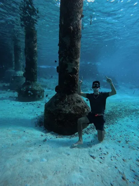
What we’re still uncovering about these places is genuinely surprising. Advances in sonar mapping, underwater robotics, and 3D reconstruction have transformed what was once a slow, limited discipline into something far more revealing. Between 2024 and early 2026, researchers using advanced diving techniques, geophysical surveys, and 3D reconstruction have revisited some of the world’s most intriguing submerged cities, revealing new details about how they functioned, why they were lost, and what still survives below the waves. Here are eight things .
1. Tenochtitlan Was an Engineering Marvel That Rivaled Any City on Earth


The Aztec city of Tenochtitlan was built on an island in what was then Lake Texcoco in the Valley of Mexico. It served as the capital of the expanding Aztec Empire in the 15th century, and at its peak it was the largest city in the pre-Columbian Americas. What makes this even more remarkable is how methodically it was built up from almost nothing. The city grew from modest beginnings, beginning as a lump of mud in the shallow lake that filled much of the Valley of Mexico.
Their hydraulic infrastructure included dams and aqueducts that provided fresh water for drinking, irrigation ditches for agriculture, and canals, causeways, and bridges for transportation. Originally located on two small islands, the city gradually spread through the construction of artificial islands to cover more than five square miles, connected to the mainland by several causeways. Spanish conquistadors who arrived in 1519 were so overwhelmed that many compared it to Venice, which was then considered the most sophisticated water city in the known world.
2. Pavlopetri Is the Oldest Known Planned City Ever Found Underwater

The archaeological site of Pavlopetri is found in Vatika Bay, off the coast of southern Laconia in Peloponnese, Greece. It is about 5,000 years old, making it the oldest submerged city known in the world, and it is unique in having an almost complete town plan, including streets, buildings, and tombs. The settlement sat above water long before classical Greek civilization even emerged, which puts it in a different category altogether from most ancient ruins we know. Originally the ruins were dated to the Mycenaean period, 1600 to 1100 BCE, but later studies showed a much earlier occupation dating back to 3500 BCE, so it also includes artifacts from the Final Neolithic Age, Chalcolithic Age, and Bronze Age.
As a snapshot of life 5,000 years ago, Pavlopetri was incredibly well designed, with roads, two-storey houses with gardens, temples, a cemetery, and a complex water management system including channels and water pipes. In the center of the city, there was even a square or plaza measuring about 40 by 20 meters, and most of the buildings had up to 12 rooms inside. The settlement was situated on an isthmus linking the island of Elafonisos with the mainland, and a combination of earthquakes and sea-level rise caused it to sink, which has in fact contributed to the site’s conservation over the following 3,000 to 4,000 years.
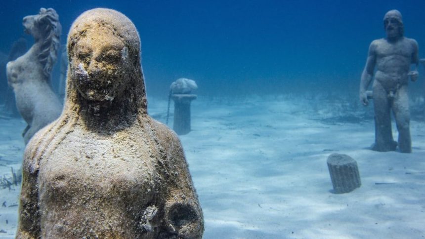
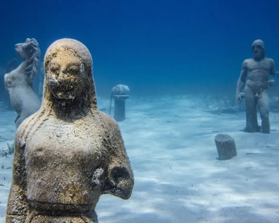
3. Thonis-Heracleion Reveals That Ancient Port Cities Were Multicultural Hubs

The Greeks named the city Heracleion, after the mythical hero Herakles, and the Egyptians called it Thonis. During the Ptolemaic Dynasty, Thonis-Heracleion was the port of entry for all Greek ships traveling to Egypt and home to the magnificent temple of Amun, where the Ptolemaic pharaohs received their divine authority. The city’s rediscovery in the late 20th century by Franck Goddio’s team was itself extraordinary. Armed with high-tech scanners and sonar, Goddio’s team detected an anomaly more than four miles off the Egyptian coast that covered nearly a square mile of the seafloor.
Submerged in Abu Qir Bay near Alexandria, Thonis-Heracleion was a major Egyptian port city linking Mediterranean trade with the Nile’s inland economy. Recent phases of underwater missions documented new zones around the Amun temple complex and identified a Greek sanctuary dedicated to Aphrodite east of it. Archaeologists believe the city was destroyed in the second century BC, when the land beneath it liquefied. The sheer scale of the ongoing finds, including statuary, trade goods, and religious objects, confirms it was one of the ancient world’s most important crossroads.
4. Water Cities Required Sophisticated Flood Control Long Before Modern Engineering
Archaeological excavations across the globe have revealed that ancient cities were not only centers of politics, religion, and culture, but also marvels of engineering when it came to water management. For cities built directly on or near water, controlling flooding wasn’t optional. It was existential. An aqueduct brought fresh water into Tenochtitlan from Chapultepec because the lake water was too saline for drinking, and flood control, another major problem, was partly solved by means of a system of dikes.
The bulk of Lake Texcoco was brackish water not good for drinking, though in the 15th century Montezuma I oversaw construction of a massive eight-mile-long levee to keep Lake Texcoco mostly fresh water and separate from the more brackish lakes. These solutions weren’t improvised. They were planned over generations, refined after floods, and rebuilt when they failed. The city’s troubled relationship with water dates to the time of the Aztecs. Heavy seasonal rainfall and flash flooding were common and could prove devastating to agriculture when Texcoco’s salty waters mixed with the fresh water of interconnected lakes.
5. Dwarka in India Bridges the Gap Between Mythology and Verified Archaeology


For decades, scholars relegated Dwarka to the realm of religious mythology, a beautiful story from the Mahabharata and nothing more. When marine archaeologists from India’s National Institute of Oceanography first discovered structured stone formations submerged in the Arabian Sea in 1983, the world was forced to reconsider. The underwater excavations were painstaking and the debates over dating remain ongoing. Between 1983 and 1990, archaeologists discovered a fortified foundation on which the ancient city walls must have been built along the river banks. Stone blocks used for construction, pillars, and irrigation systems were found, but a debate is still ongoing regarding the dating of the vestiges, either from 3,000 to 1,500 years BC or from the Middle Ages.
Perhaps most compelling is the discovery of over 120 stone anchors of various types, some weighing up to 496 kilograms. Published research in the International Journal of Nautical Archaeology documents these findings extensively, with marine archaeologists identifying three distinct anchor types, including composite triangular anchors made from locally available limestone and grapnel-type anchors associated with Arab maritime trade. After a 20-year hiatus, the Archaeological Survey of India’s Underwater Archaeology Wing resumed explorations in February 2025, led by Prof. Alok Tripathi, and for the first time the team includes three women archaeologists, making this expedition both historically and symbolically significant.
6. Atlit-Yam Shows That Coastal Settlements Were Lost to Rising Seas Thousands of Years Ago

Discovered in 1984 in the shallow coastal waters near Haifa, Israel, Atlit-Yam is a Neolithic site that was first settled around 6900 BC, making it by far the oldest known human settlement found underwater. The inhabitants of Atlit-Yam were farmers and fishermen who occupied a fertile stretch of land left behind by the receding Mediterranean Sea. They planted wheat and pastured animals. The site was not a city in the grand sense but rather a settlement that reveals something essential about how early coastal communities organized themselves around water. One of the most intriguing discoveries at Atlit-Yam was a circle of large, upright stones that some archaeologists compare to Stonehenge. The stones surround a natural spring and may have served a ceremonial purpose, as an open-air sanctuary where the ancient farmers made offerings for their agricultural bounty.
Using geomorphological, sedimentological, and paleontological data from the seabed, scientists have established that between 30,000 and 20,000 years ago, during the last glacial maximum, sea level was some 425 feet lower than it is today. At the end of this period, the sea level rose abruptly as polar ice caps melted, and many prehistoric settlements built along the coastlines flooded and were abandoned. Atlit-Yam is one of hundreds of such places. The Submerged Prehistoric Archaeology and Landscapes of the Continental Shelf project has recently counted roughly 2,600 such submerged sites in 19 countries.
7. Baiae, Rome’s Pleasure City on the Water, Is Still Giving Up Secrets
The Roman resort town of Baiae, once Rome’s answer to the modern concept of a seaside destination for the elite, now lies largely submerged in the Bay of Naples. Unlike many ancient water cities, Baiae was not a trading hub or a fortress. It was a place of spectacle and luxury, and the archaeology reflects that. In July 2024, researchers reported an ornate underwater mosaic floor linked to a Roman villa within the submerged archaeological park, highlighting the town’s elite architecture and expensive decorative techniques.
In August 2025, archaeologists announced the discovery of a submerged Roman bathhouse with features consistent with Roman heating and bathing infrastructure, and some reports suggested it may relate to a high-status villa tradition associated with Rome’s political class. The fact that Baiae continues to produce headline discoveries speaks to how much of the ancient world’s waterfront life remains unexplored. Together, these finds show Baiae isn’t just a known site. It’s still yielding new, headline-grade urban discoveries.
8. Modern Technology Has Fundamentally Changed What We Can Learn From Submerged Cities

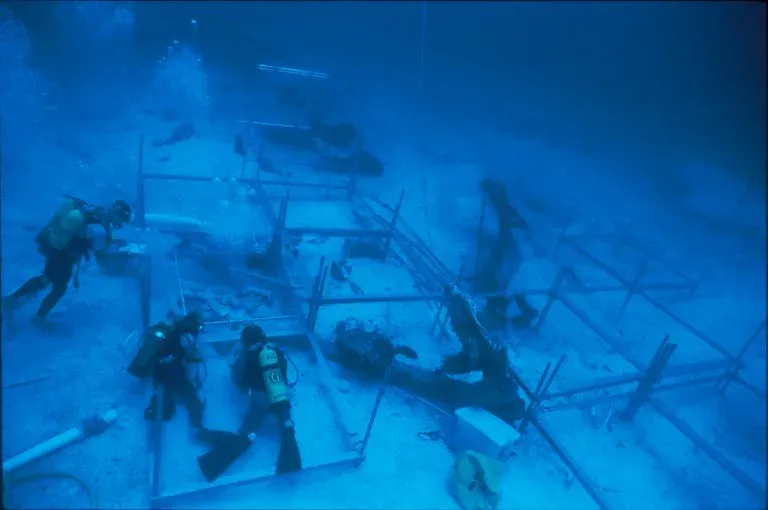
The Mediterranean Basin, including the Black Sea, contains numerous sites beneath its waves. These sunken sites are now the hunting grounds for today’s underwater archaeologists using the latest technologies, including SONAR, robotics, 3D scanning, and underwater cameras. The shift from purely physical excavation to digital reconstruction has been enormous. Researchers from the Japan Agency for Marine-Earth Science and Technology, Kyoto University, and partner institutions published a high-resolution 3D reconstruction of a submerged settlement using multibeam echo-sounder surveys combined with historical cadastral maps. The work identified town blocks, roads, waterways, and shrine approaches preserved on the lakebed, transforming written history into a mapped urban landscape.
Pavlopetri became the first underwater city to be fully digitally mapped and recorded in three dimensions, and then brought back to life with computer graphics. That milestone opened the door for similar approaches across dozens of other sites. Advances in 3D scanning and digital modeling allow researchers to record details without physically disturbing fragile structures. What once required physically moving through hazardous, low-visibility water can now be accomplished with a level of precision that field excavation alone could never match. The picture that emerges, across site after site, is that ancient people were far more capable water-city builders than anyone assumed just a few decades ago.
The study of is, in many ways, still in its early stages. Each new survey season produces findings that force a revision of what we thought we knew. The cities themselves had different reasons for choosing water as their foundation, but they share something in common: they were built by people who understood their environment deeply enough to make it work, sometimes for centuries at a stretch.