

Scientists warn El Niño could intensify climate extremes in 2026 – Image for illustrative purposes only (Image credits: upload.wikimedia.org)
Climate researchers are tracking the likely emergence of a strong El Niño this year against a backdrop of already elevated global temperatures. The natural cycle, driven by warmer Pacific waters, is expected to develop within weeks and could push 2026 toward the top of the historical temperature rankings. Forecasters note that the overlap with human-driven warming raises the stakes for weather patterns worldwide.
Why the Timing Matters
Global temperatures have already set records in recent years, with 2024 marking the first time the annual average exceeded 1.55 degrees Celsius above pre-industrial levels. A new El Niño would build on that baseline rather than starting from cooler conditions. Scientists at the World Weather Attribution group describe early 2026 conditions as extraordinary, including near-record sea-surface temperatures in April and the second-lowest Arctic sea-ice extent on record.
March brought a U.S. heatwave that analysis shows would have been virtually impossible without climate change. These developments indicate that even before El Niño fully arrives, the planet is experiencing heightened variability. The combination could accelerate the pace at which new extremes appear.
How El Niño Interacts With Warming
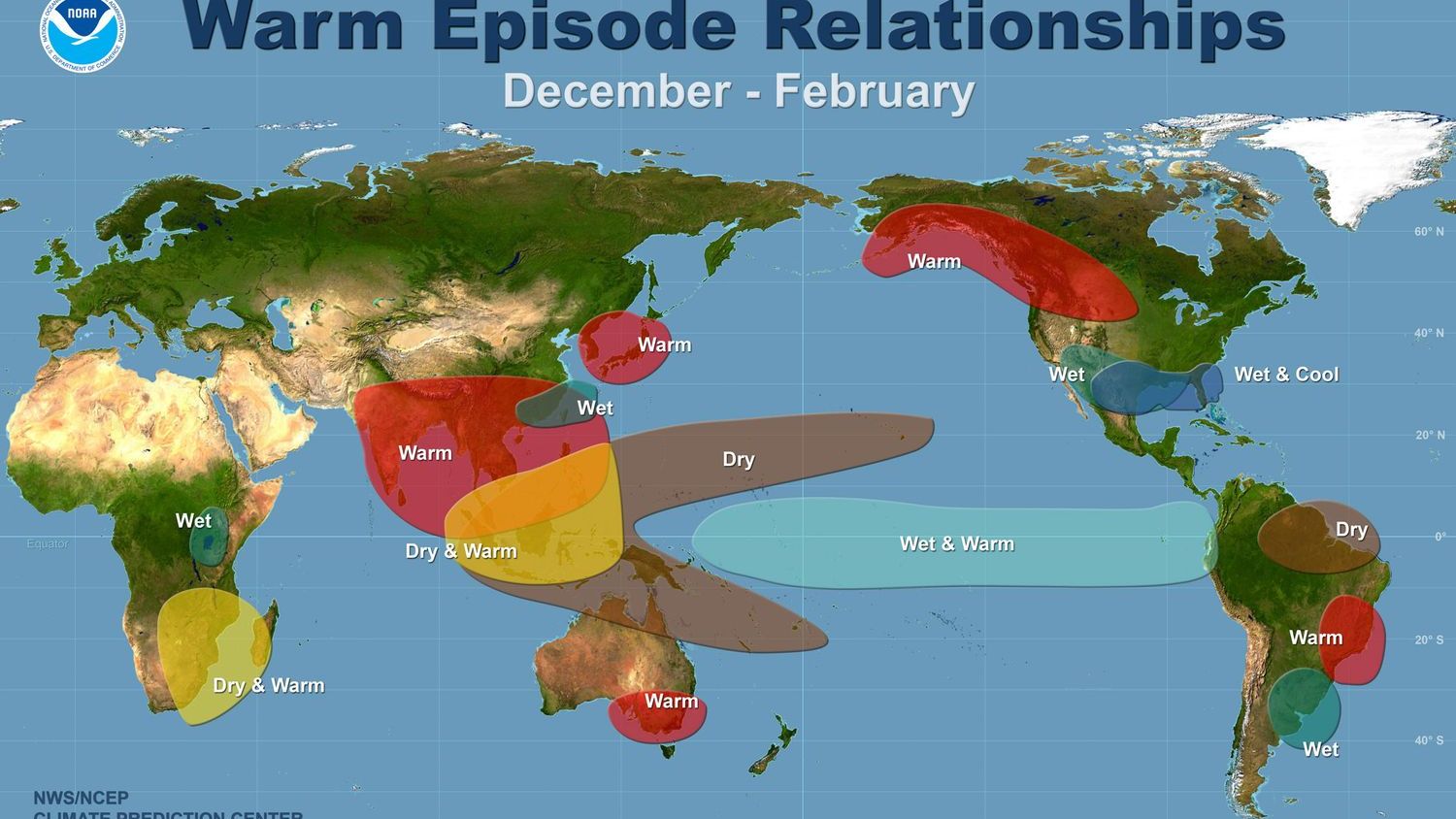
El Niño itself is a recurring natural event that shifts heat from the ocean to the atmosphere. In isolation it produces familiar shifts such as drier conditions in parts of Australia and Southeast Asia and wetter weather along the western coasts of the Americas. When layered onto rising background temperatures, however, the same shifts can produce more intense outcomes.
Imperial College London climate scientist Friederike Otto has emphasized that the phenomenon is not new, yet its effects now unfold on a dramatically altered planet. She noted that records will continue to fall primarily because of ongoing fossil-fuel emissions rather than the strength of any single El Niño. The World Meteorological Organization plans to release updated guidance in late May to help governments prepare.
Projected Effects on Fires, Droughts and Storms
Early wildfire activity already points to elevated risk. Record fires across Western Africa, the Sahel, India, Southeast Asia and parts of China produced the largest burned area for any January-to-April period on record. A strong El Niño would likely extend hot, dry conditions into Australia, the western United States, Canada and the Amazon, raising the chance of severe fire seasons.
At the same time, other regions could see heavier rainfall and flooding. The precise regional pattern remains uncertain until the event’s strength is confirmed, but researchers stress that the overall likelihood of harmful extremes is higher than in previous decades. Theodore Keeping of World Weather Attribution stated that the potential for damaging fires could reach the highest levels seen in recent history if the current forecast holds.
What matters now: Decision-makers have a narrow window to strengthen early-warning systems and protect vulnerable communities before peak impacts arrive later this year.
Looking Ahead
Forecasts will sharpen over the coming weeks, yet the underlying trend is already clear. Continued emissions keep raising the floor beneath every natural fluctuation, so even a moderate El Niño can produce outsized effects. Preparation now, rather than reaction later, offers the clearest path to limiting harm.


