
Most people who visit Las Vegas never make it past the slot machines. That’s fine, honestly. But just 17 miles west of the Strip sits one of the most spectacular, and surprisingly underappreciated, wild spaces in the entire American Southwest. It’s loud with silence, blazing with color, and full of trails that the average tourist simply never hears about.
More than three million visitors every year enjoy the spectacular desert landscape, climbing, and hiking opportunities at Red Rock Canyon. Yet somehow, a huge portion of those millions all end up at the same three or four trailheads, leaving entire canyon systems almost completely empty. That’s exactly where the locals go. So let’s get into it.
Why Red Rock Canyon Is So Much Bigger Than You Think
The Red Rock Canyon National Conservation Area encompasses 195,819 acres within the Mojave Desert. Think about that for a second. Nearly 200,000 acres, and most visitors only explore a tiny sliver near the main scenic loop. It’s like visiting New York City and never leaving Times Square.
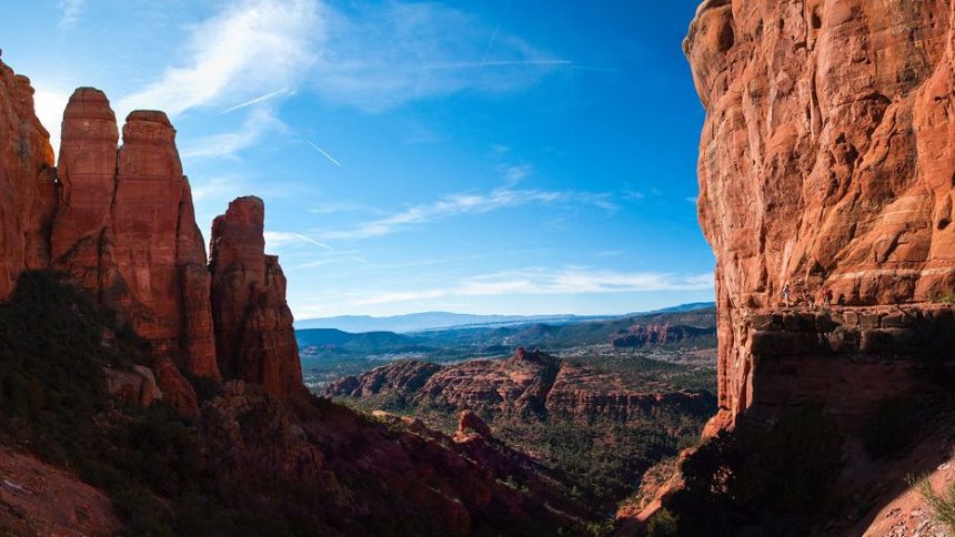
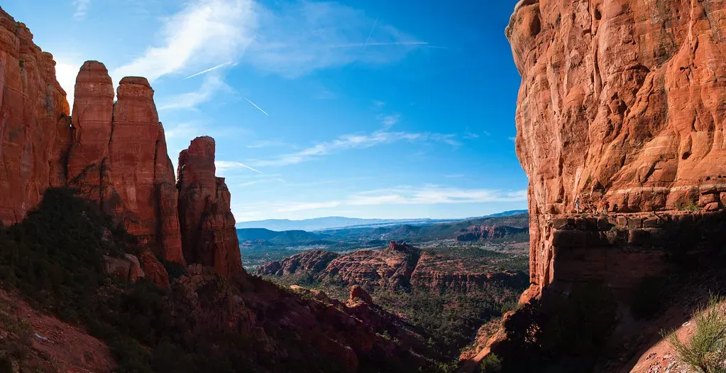
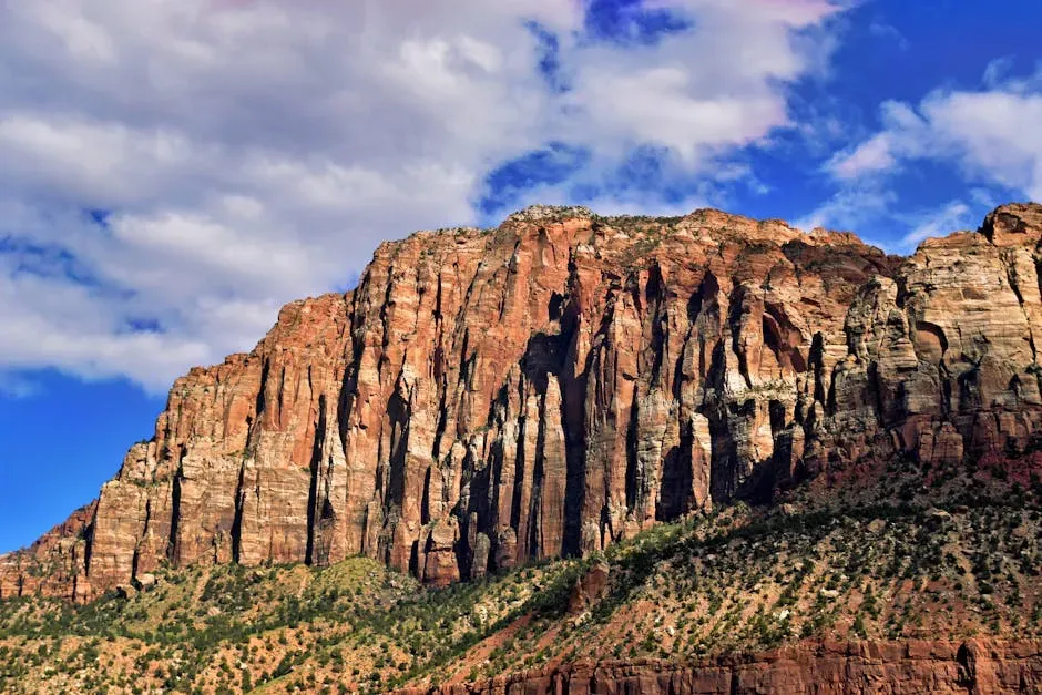
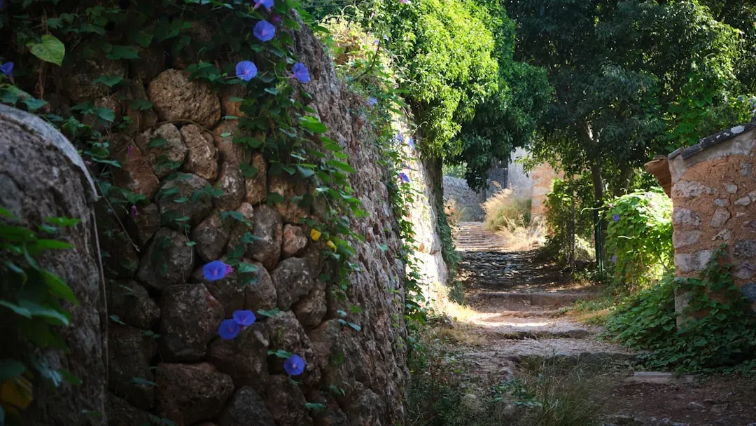
Red Rock Canyon is a maze of canyons and peaks, ledges and chimneys, chutes and gullies leading to surprises around every wall, with 26 different hikes and trails that take you from the deep canyons to the highest points. Even with 26 official trails, there are social and informal routes that locals have been quietly using for years. Red Rock Canyon has more hiking than most visitors realize, including slot canyons, scrambling routes, sandstone ridgelines, quiet basins, and an entire world of scenery. With over a dozen official trails and even more social routes, choosing can get overwhelming.
Guardian Angel Pass: The Local Favorite Nobody Talks About
Here’s the thing about Guardian Angel Pass. Ask a tourist about it and you’ll get a blank stare. Ask a Las Vegas local who hikes, and watch their eyes light up.
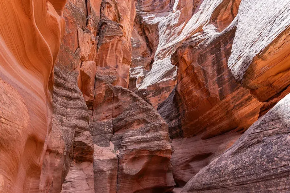
At roughly 3.2 miles and rated strenuous, Guardian Angel Pass is a local favorite most visitors never hear about. It combines sandstone scrambling, hidden features, and a true “desert playground” feel. The route wanders through Calico Basin before climbing to a narrow pass with sculpted walls and the namesake rock feature tucked into an overlook. It’s adventurous without being extreme and offers a quieter experience compared to the Scenic Loop. One honest warning though: the views at the pass are outstanding and the scrambling is genuinely fun, but the route isn’t well marked and it’s easy to drift off trail.
Kraft Mountain Loop: The Climbers’ Secret Playground
Most visitors have never heard of Kraft Mountain. That’s almost criminal, given how good the terrain is out here.
The Kraft Loop circles the full base of Kraft Mountain, mixing ridge views, sandstone formations, and steady ups and downs. The climb known as “Hell Hill” hits early, but the trail pays you back with colorful canyons, sculpted rock, and constant variety. It’s a favorite with hikers and climbers and one of the most photogenic routes in Calico Basin. The Kraft Mountain Loop Trail is a hidden gem among hikers, offering light scrambling and stunning views without the crowds. It’s the perfect way to scout future climbs or simply soak in the desert’s beauty from a different perspective. If you want something that feels nothing like a tourist trail, this is it.
Pine Creek Canyon: The Desert Oasis Most People Drive Right Past
Pine Creek Canyon is one of those places that sounds ordinary on paper. Then you walk into it and realize you’ve stumbled into something special.
Pine Creek Canyon offers some of the best of the Red Rock Canyon National Conservation Area, with beautiful and diverse plant communities nestled at the bottom of monolithic canyon walls, covering 2.4 miles at an easy to moderate difficulty. This entire side of Red Rock Park is often overlooked by those who spent their time at the more popular visitor center, the Calico Hills, Turtlehead Peak, upper viewpoint, Willow Springs, and Ice Box Canyon. However, Pine Creek Canyon is definitely worth a day or two. It is more wild, untouched, and the plant life more varied and abundant. The canyon features open desert, an old homestead site, and an optional figure eight loop called Fire Ecology which cuts through an area of ponderosa pine. I think the combination of history and nature here is genuinely unmatched in the park.
Ice Box Canyon: A Cool, Hidden World Inside the Desert
Imagine being in the middle of the Mojave Desert and suddenly hearing the sound of rushing water, birds singing, and feeling the temperature drop by ten degrees. That’s Ice Box Canyon.
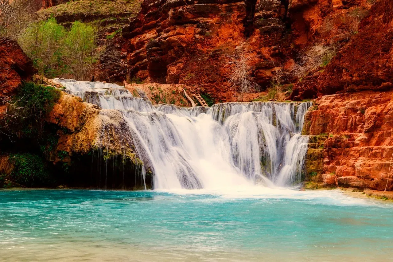
Ice Box Canyon, located on the Eastern side of the Rainbow Mountains between Willow Spring and Pine Creek Canyon, is one of the more compelling hikes in Red Rock Canyon. The brief 2.2-mile hike introduces the beauty and challenge of traversing the brush, boulders, ledges, and streams in the canyons on the Eastern side of Nevada’s Rainbow Mountains. In the early spring the creek in Ice Box Canyon continually sings as water cascades over rocks and boulders and into peaceful pools. You’re in a lush pine forest where the singing of birds adds to the orchestra. It’s such a contrast from the stark arid setting in the center of Red Rock Canyon. The highlight is a seasonal waterfall that flows during the winter and spring months, making it a popular choice for those looking to escape the heat of the desert.
First Creek Canyon: A Hidden Waterfall and a Quiet Grotto
Waterfalls in the Mojave Desert? It sounds like a punchline. It’s not.
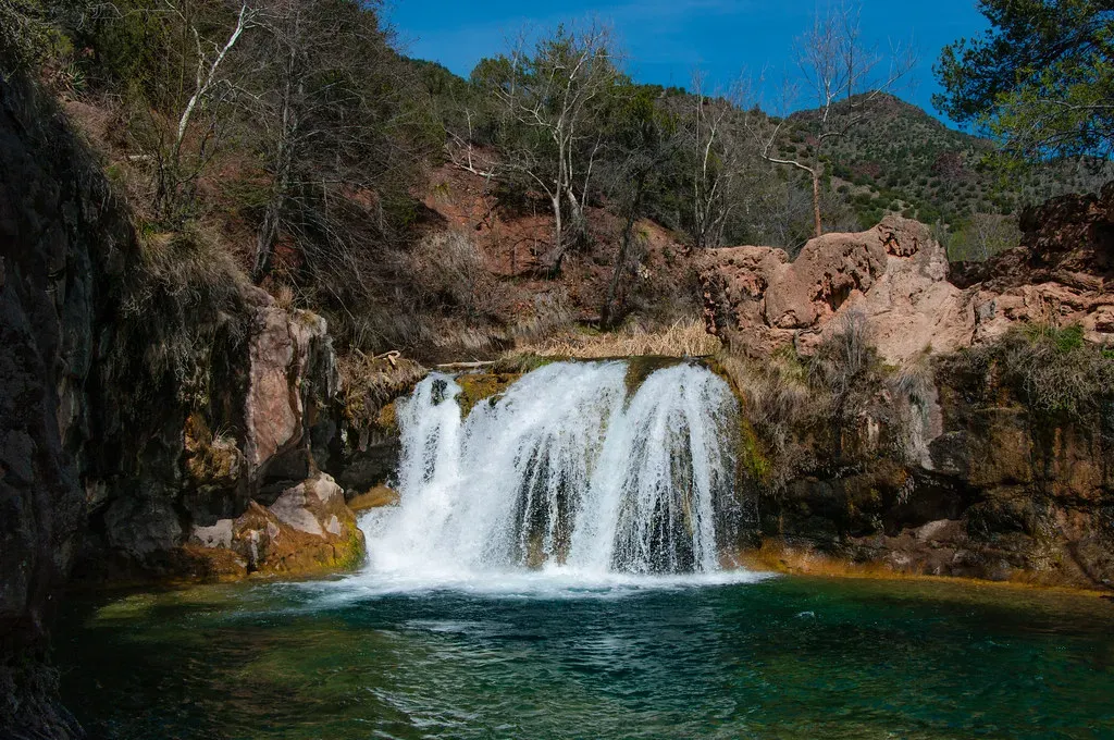
First Creek Canyon Trail offers a scenic hike that leads to a hidden waterfall and a small grotto. The trail winds through open desert before entering the narrow canyon, where hikers can enjoy the cool shade and tranquil setting. It’s a great option for those looking to explore off the beaten path. The trail is roughly three miles round trip with a modest elevation gain of about 300 feet, making it approachable for most fitness levels. This trail traverses open desert before entering the canyon, where tricky boulder hopping is required to reach the back, where a seasonal waterfall can be found among the narrow walls. The catch is that the waterfall depends entirely on recent rainfall, so timing matters.
Turtlehead Peak: The Summit the Tour Groups Never Reach
Let’s be real. Most people see Turtlehead Peak from the road, snap a photo, and drive on. The locals actually climb it.
At 4.6 miles with an average time of three and a half to four and a half hours and rated strenuous, this hike features sweeping views from a choice Red Rock Canyon peak. Although it’s not an easy climb, Turtlehead Peak is one of the most accessible peaks. Turtlehead Peak Trail offers a challenging hike with a significant elevation gain. Hikers will navigate steep paths, rocky terrain, and narrow ledges. The reward for reaching the summit is a panoramic view of the entire Red Rock Canyon area and the Las Vegas Strip in the distance. The early morning light up here is something else entirely. Go before nine, and you might have the whole summit to yourself.
The White Rock Mountain Loop: Ridge Views Without the Madness
White Rock Mountain is one of those trails where the length itself acts as natural crowd control. It’s not brutal. It’s just long enough to weed out the casual visitors.
Locals note a steady mix of terrains, a quiet feel, and how well-marked the trail is compared to Calico Basin routes. The mileage helps thin out crowds, which makes the loop feel more peaceful than most Scenic Loop trails. The eastern side of the loop has endless rocks underfoot, and wind exposure can be rough on blustery days. For the entire length of Dales Trail, which connects to this area, you’re getting a spectacular mountaintop view up, down, and across Red Rock Canyon and beyond. There is White Rock Mountain and the La Madre Mountains cliffs to the North, Turtlehead Peak, Damsel Peak and the Calico Hills to the East. Honestly, the views reward every single step.
Petroglyph Wall and Lost Creek: Ancient Art Hidden in Plain Sight
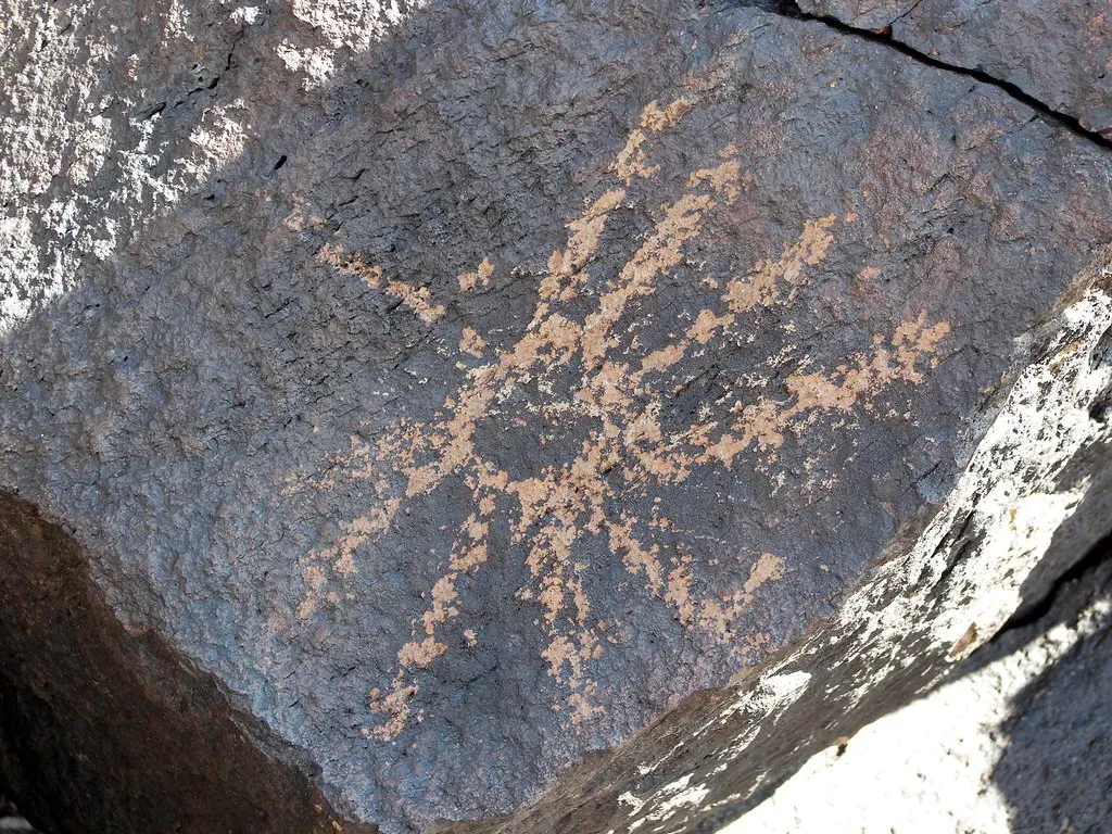
There’s something genuinely moving about standing in front of ancient rock art in the middle of the desert and realizing almost nobody else knows it’s there.
At Petroglyph Wall, you’ll cross a wash and find a cliff wall filled with rock art which is partially hidden behind a juniper tree. Lost Creek is a fun easy hike because it features several plant species, cultural sites, and after rainfall there may even be a picturesque waterfall on the trail. Petroglyphs and abandoned cliff dwellings can be found throughout the wilderness area. These two trails sit side by side and can be done together in well under two hours total. The Calico Tanks trail, not far from this area, has a plaque about prehistoric agave roasting pits, a reminder that these lands were home to people long before Las Vegas existed.
Practical Tips the Locals Actually Use
Knowing the trails is only part of the equation. Showing up prepared is what actually makes the difference between a great day and a miserable one.
From October through May, reservations are required for the scenic drive between 8 AM and 5 PM. Avoid crowds and desert heat by starting before 9 AM. Entry is $20 per vehicle, or $8 per cyclist and $5 per pedestrian per day without a National Parks pass. Red Rock Canyon NCA is a desert environment with very limited food and water options, with no water or food available on the one-way 13-mile scenic loop or hiking trails. Temperatures can routinely exceed 105 degrees Fahrenheit in the summer, so plenty of water is essential. Visitors hiking into the backcountry off established trails are advised against traveling alone and should inform other people of their plans.
Conclusion
Red Rock Canyon is one of those rare places that genuinely rewards the curious. The more you’re willing to wander past the obvious trailheads, the more it gives back. Millions of people visit every year, yet entire canyon systems sit almost completely silent on any given weekday morning.
The trails the locals love aren’t hidden because they’re difficult to find. They’re hidden because most people simply don’t look. Next time you’re anywhere near Las Vegas, maybe skip the fourth buffet and drive west instead. What would you rather tell people you did when you got back home?


